Drones & Robotics


Orbital Engineering Drone Services
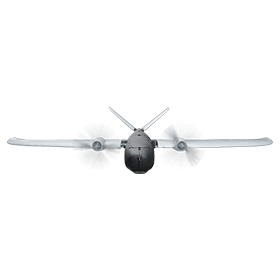
Orbital Engineering applies advanced technology to solve asset management problems in the Energy, Mining, Metals, Chemicals and Manufacturing Industries. Our Advanced Data Collection solutions reduce costs, minimize worker exposure to safety hazards, and eliminate plant outages to perform aerial surveys and inspections of high rise, underground or difficult to access assets.
We add value beyond simply collecting data by applying more than 50 years of engineering and inspection experience to provide specific technical recommendations. We then apply a sophisticated Risk Based Inspection approach to asset programs and organize and manage asset data through custom Enterprise Asset Management systems.

Additional Drone Services include:
- Aerial mapping
- Difficult to access inspections, such as:
- Bridges
- Stacks
- Flares
- Conveyors
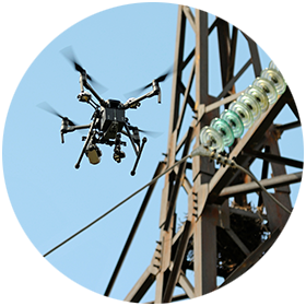
- Transmission lines and Towers

Robotic Systems
Services include:
- Magnetic crawler stack and tank inspection
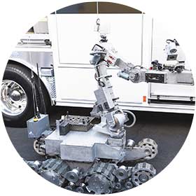
- Remote robotic ground-based inspection:
- Restricted access
- Confined spaces
- HazMat
- Ventilation Restrictions
Robotic Systems Videos:
- Magnetic ROV Inspection
- Boiler Superheater Inspection
Software
Software Development & Database Services
Orbital Engineering is more than a highly capable engineering firm, we also offer custom and pre-constructed software and database solutions, including:
- Software Application Development
- Microsoft Access Maintenance And Development
- Microsoft Store Development for Win 8.1+ (tablets and desktops)
- Database Design and Development Services
- Cloud and Premise Application Hosting Solutions
- Website Development and Maintenance
- In-house Development Team
Enterprise Asset Management Solutions
- Seamlessly manage inspection and maintenance information
- Asset and repair prioritization based on risk factors
- Streamlined report generation
- Cloud-based database with browser interface
- Custom workflows and user alerts
- Tablet-based mobile application streamlines data collection and reduces report preparation time
- Customizable applications including:
- Structural and mechanical assets
- QA/QC construction inspection
- Pipeline inspection
Data Processing and Analysis
- Visual feature extraction
- Photogrammetry
- Dense point clouds
- 3D CAD model generation
- 2D and volumetric measurement
- GIS data integration
- Engineered repairs, designs and analysis
Advanced Technology
- IR cameras (handheld and Drone Mounted)
- NDT robots from for as small as a 6 inch diameter pipe
- High Powered Optics with 13X optical zoom
- LIDAR
- Sediment mapping
- Photogrammetry
Projects
Coke Drum Internal Weld Seam Visual Inspection with ORBCAM
The objective of this project was to complete an internal visual inspection of the weld seams on the inside surface of a coke drum shell. The ORBCAM required a tripod with a winch at the top of the coke drum for operating the vertical movement of the ORBCAM. To ensure the ORBCAM does not move in a pendulum motion while descending two guide ropes were used, both secured at the top and bottom. The ORBCAM’s payload included a 4K camera with LED lights all mounted on a self-balancing gimbal. The gimbal allowed the camera to rotate 360 degrees plus pan up and down. The camera additionally had an optical zoom of 13x. The gimbal movement was operated with a wireless controller from the coke drum discharge. A monitor was set-up to view the video feed live.
The inspection in the past was completed using a point and shoot camera mounted onto the stem set to record video. The past inspection method provided limited information since there were no real live controls and minimal lighting. Customer documentation of the weld seams and past repairs assisted in the inspection. The ORBCAM allowed for a systematic process to inspect the weld seams and to easily update the weld seam drawing. This inspection has helped the customer plan for a future turnaround. Prior inspections required the customer to guess on the needed weld repair magnitude. The inspection was completed in a day and depending on facility operations the work could be completed in a half day.
Cooling Tower Inspection
The objective of this project was to complete a visual inspection of a hyperbolic cooling tower at a power generation plant and then use the photographic data to complete a 3D model of the structure. The customer will use the data to prioritize maintenance activities and use the 3D model to provide clear scope details for contractor repair pricing. Orbital flew multiple vertical flights to compile data. Both standard 4K photographic data and infrared data were recorded. The photographic data recorded was imported into Pix4D software that allowed the creation of two individual 3D models of the cooling tower – standard and infrared. A DJI Inspire 1 UAV was used for the inspection.
- Onsite time: 8 hours
- Flight time: 3 hours
The customer in the past had contractors’ rappel down the side of the cooling tower during an outage to inspect and repair at the same time. This method has some inefficiencies such as outage required, scope of repair work not known prior securing contractor and a lot more time required. Use of the UAV keeps personnel out of exposures to hazards.
Metering & Regulating Station UAV Flight and Modelling
The objective of this project was to complete a flight over an existing M & R station for a customer and then use the data to complete a 3D CAD model for as built use. This allowed the customer to validate the installation and to have an actual model of the station assets for future inspection and other maintenance activities.
- 250 Geo-tagged Pictures
- Onsite time 1.5 hours
- Flight Time 12 mins
- Full Autonomous flight with Geo Fence (Red Boundary)
Overhead Crane Runway Inspection
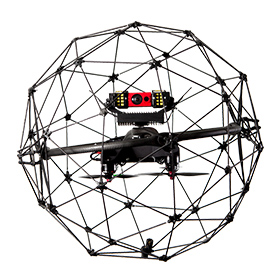
The objective of this project was to complete a visual inspection of crane runways in a steel production facility. Using an UAV allowed for limited production impacts but still allowing the structural condition of the runway’s key structural components to be inspected. Orbital flew along the runways with a Flyability Elios UAV recording video during the flight. The video recorded was reviewed by an engineer to compile deficiencies that require maintenance activities to ensure the integrity of the runways. A final inspection report was created listing each deficiency with a picture, location and required mitigation.
- Onsite time: 10 hours
- Flight Time: 4 hours
The customer impacted operations by needing to lockout the crane for longer periods to complete the inspection by walking the runways or with use of a manlift. Additionally, having personnel at height is a safety hazard. So using the UAV allowed for a more efficient inspections with less operational impact and limited personnel exposure to work hazards.
Stack Internal Inspection
The objective of this project was to complete an internal inspection of a stack linear. This inspection is typically completed with a large cost and exposing personnel to safety hazards. The UAV allowed the inspection to be completed in one day. This type of inspection can be planned and completed more efficiently than the typical inspection. The UAV had prop guards and was tethered to ensure it was not pulled out the top of the stack by the draft.
- Onsite time 6 hours
- Flight Time 1.5 hours
During the inspection monitors were viewed by inspection personnel to ensure any critical deficiencies were detected immediately. After the inspection, the video was reviewed, and a formal report was developed using pictures pulled from the video showing deficiencies. The deficiencies were clearly located on the stack in the report with the use of drawings. The report included repairs recommendations for all deficiencies.
Terminal Containment Volumetric Calculations
The objective of this project was to complete a site survey with a UAV. The survey data was used to complete site topographic drawings showing runoff patterns. The customer additionally requested Orbital to validate the containment volume for each tank. Orbital flew over the terminal area with a DJI Inspire UAV recording photographic data during the flight. The photographic data recorded was then imported into Pix4D software to complete point clouds and volumetric calculations. The software allows the technician to make any needed model corrections to ensure an accurate output. Orbital increased the accuracy of the output data by recording data for 23 control point on the site. The control points were determined by Orbital’s personnel and each control point was recorded with a Trimble Geo 7 Series Premium Centimeter GPS System. The GPS data for each control point was entered into the Pix4D software.
- Onsite time: 6 hours
- Flight Time: 5 hours
The customer was completing the volume calculations manually. This method was not giving them accurate data. Additionally, the manual method could not locate the low spots on dikes where the overflow could occur. Use of the UAV has proven to be safer, more accurate and more efficient.
UAV Inspection
Unmanned Aerial Vehicle (UAV) Inspections combined with Alignment Surveys of Crane Runways Orbital Technical Solutions (OTS) provided Asset Integrity Services with use of Unmanned Aerial Vehicles (UAVs) and survey equipment. The equipment was used to complete visual...

